Drone aerials:


Drone aerials:
No change in the last two days. The water has dropped, but not visibly.
Dozens of the curious and loyal continue to visit the Trim Road barricade daily, many of them people who visit the island almost daily under normal circumstances. They bring cameras and binoculars and enjoy the large number of birds present, along with a few muskrats and beavers. A captive audience for a membership drive…
Owner Yves and staffer John boated into the marina again today and are performing some duties. It seems that a few of the stored ice huts are flooded.
When waters recede, the City will have to clear and repair the access road before barricades are removed for the general public. By then I’m sure some os us will have gone out to inspect, either by human-powered boat or by human-powered boot (Steve: pun intended).
Waters are being held back in the upstream reservoirs (kilowatts will be distributed to taxpayers over time). If we do not have the kind of rain in Mat that April showered us with, things should be “normal”, meaning the regular spring freshet situation: no land access to Muskrat and Holland trails.
I don’t think any of the power outlets inside or outside the two buildings are low enough to have shorted out the power and popped the breakers.
Here are a few more pics- I took them from a mini kayak yesterday.

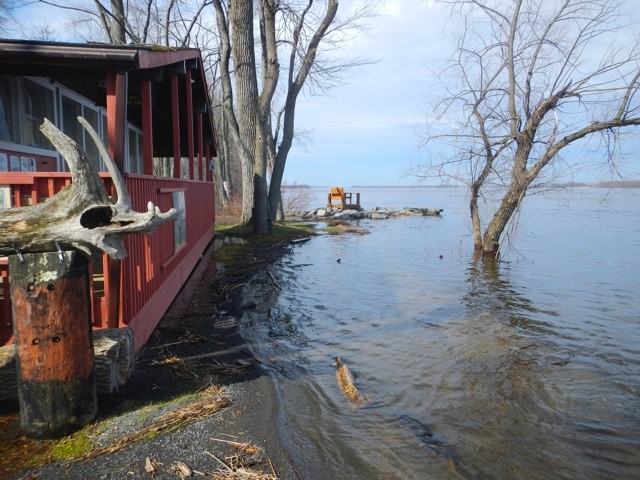
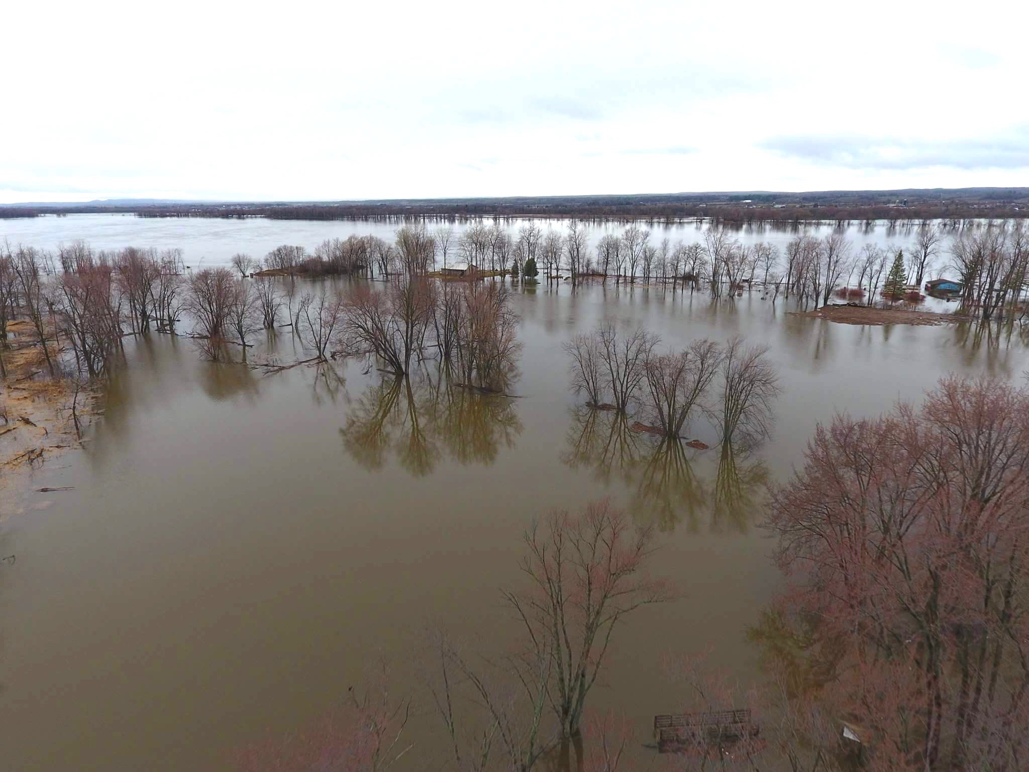
River continues to rise to unprecedented levels. Gained a few feet longitudinally on the access road.
I had an exchange of emails with Yves Grandmaître, who has known the island since childhood and remembers floods in years long past. He was unequivocal: there will be a few inches of water over the floor of the Interpretive Center. Assume a nice clean ground surface in our work shed, and some swollen plywood flooring at the Petrie Island Trailmaster Lodge & Resort. Also assume that some of the ash trunks left by Forestry will be wandering. Hopefully some of the branches will travel to the nether reaches of the Ottawa. Steve and I will be taking bets on where the wrecked timber crib off Muskrat will end up after Noah decommisions the ark.
(Ozile’s runaway canoe was retrieved, in case anyone noticed it east of the barricade)
The photo here was taken May 1, 2013, when water was under 43.5 m ASL. We are now over 44 m. I trust we chained the bench platform.
I was unable to inspect any distant locations from North Service due to thick fog. I have no intention of trying to take the kayak out to the cottage until the current slows down or the water allows us to reach beyond the causeway.
http://ottawariver.ca/river-levels-flows.php – updates around 1400 hrs daily.
Here are some videos taken on Petrie Island by Bill Bower during the summer of 2016.
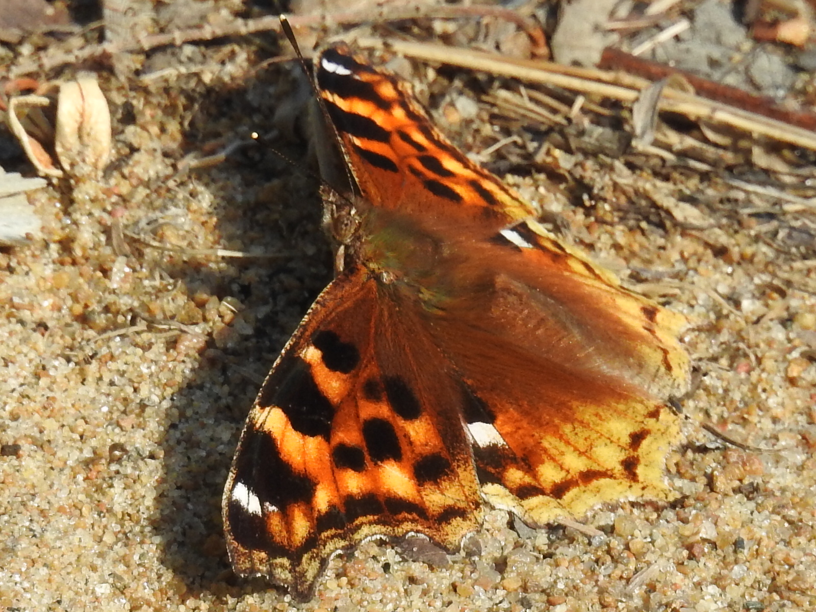
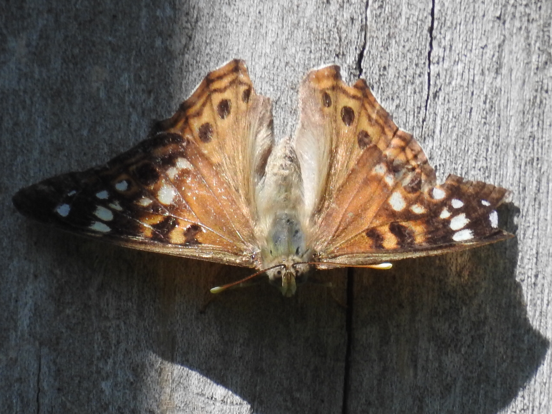
Twenty years ago you wouldn’t have found any of these three butterflies around Petrie Island or around Ottawa for that matter.
All three were found down the Bill Holland Trail within about 300 – 400 yards of one another. I found the Buckeye on Sept. 15th. Their northern range would be northern New York State and Southern Ontario, Sightings around Ottawa over the years have been few and far between. One year there was a small colony located in the Ottawa area which meant that a female with eggs made it this far north. They would not have survived the winter. All old sightings were made in September as well. There has never been a sighting reported from Petrie Island that anyone can remember. I wonder with global warming has anything to do with it.

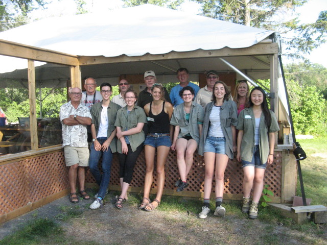
2014 was a very successful season which saw 626 visits by school children from 10 schools and 715 Junior Naturalists and parents attended 35 sessions. The nature centre had over 7000 visitors in 2014. The Rideau Canoe and Kayak club’s second year of summer kayaking camps were a hit and we look forward to collaborating with the club again for a third summer. Over 100 volunteers contributed over 1000 hours on environmental projects for the Ontario Trillium funded Native Flora Program. The adult nature tours were also a success with 67 people attending the four events. Full report on FOPI activities can be reviewed on the Studies and Reports page under Committee Reports. In 2015, we will be completing our 2nd year of a Trillium grant which will include tree wrapping for protection from beavers, removal of invasive species, planting of shrubs and trees to prevent shoreline erosion along the river and improving our wildflower garden. If you would like to volunteer for any of these activities please email: floraprogram2014@petrieisland.org.
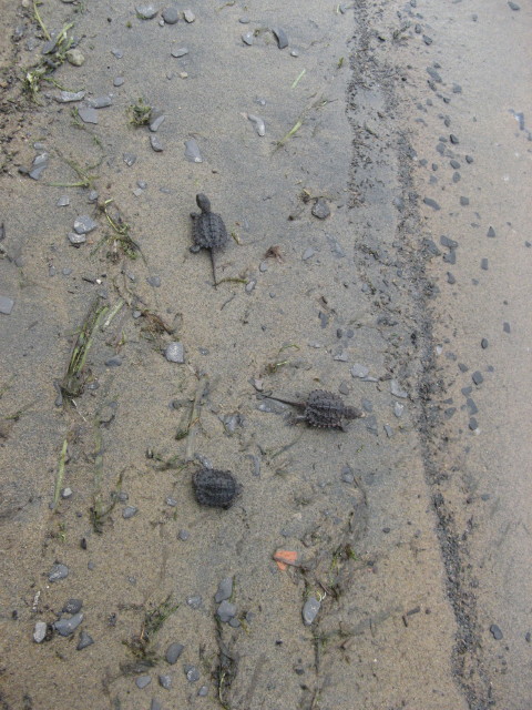
On an early May Saturday Al Tweddle and Eva Kasanda hosted 41 intrepid Jane’s Walkers on a Turtle Trail walk and talk. This year the Ottawa River cooperated allowing the visitors access to the island and the Grand Maitre Nature Reserve. The tour started in the Interpretive Centre, providing shelter from some light rain and allowing visitors to learn about the efforts of the Friends of Petrie Island and the wildlife that lives on the island. Outside one brave Map Turtle (Graptemys geographica) showed his (or her) face and Eva Kasanda introduced the group to a pet Red Eared Slider (Trachemys scripta elegans) turtle (courtesy of Bill Bower) and she talked about the dangers of releasing this type of non-native species into the wild.
The tour finished up with a visit to the Experimental Turtle Nesting Site. Al and Eva received lots of great questions and comments and FOPI is looking forward to hosting more walks and talks this year! Promotion of this event and other Jane Walks were seen in Apartment 613, Green Living Ottawa and the Ottawa Citizen! Thanks to everyone who came out!
At 11 am Sunday, we attempted to enter Petrie Island but found the road was closed and water levels were still high. We managed to get to the nature center wearing rubber boots and noted that 50% of the picnic area was under water. On our way in we saw 3 painted and 4 mapped turtles basking along the
turtle trail. We saw 2 geese and 3 goslings swimming through the picnic area. The Bill Holland (BH) trail was completely flooded in the picnic area portion. We ventured to the end of the BH trail by boat, landing where the beaver loop begins. We spotted two muskrats along our boat ride, as well as a heron along the river shore. Along the loop we found a beaver lodge, which
is new this year. Portions of the beaver loop are too flooded to walk through.
We proceeded to the sand dune at the west end of the trail, on our way passing a collection of Bladder Nut. As we approached the Ottawa River shoreline we found that the sandy beach along the River Trail was completely under water.
Water levels have receded since their peak on Thursday the 22nd. We
expect the road to be open in the next day or so. Rubber boots are
recommended on the trails – however in some areas water levels may go above
the top of your boots, watch your step!

Figure 1. A
beaver caught eating dinner !

Figure 2.
Flooded picnic area at Petrie Island.

Figure 3.
Eva, one of our monitors trekking through the flooded picnic area.

Figure 4. A
muskrat seen along one of the nature trails!