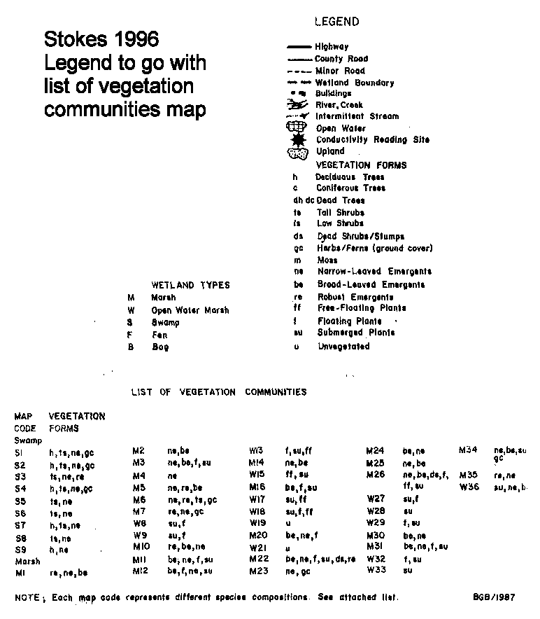
Eastern Forestry … Plus!
Forestry and Wetland Management
Robert W. Stokes, B.Sc.F., R.P.F.
Consulting Professional Forester
Wetland Evaluator
A Comparison of the Current Wetland Boundary Mapping for
Petrie Islands, and Baie Lafontaine Provincially Significant Wetlands
with Mapping Produced Using the Ontario Wetlands Evaluation System,
Southern Manual, 3rd Edition, 1993
Prepared By: Robert W. Stokes, R.P.F.
Wetland Evaluator
November 1996
Background Preparation:
The task of assessing the Petrie Islands Wetland started by gathering together the relevant information to allow for the collection of field data. Current wetland maps and copies of aerial photographs (I 99 1) were obtained from the Carleton Place office of the Ontario Mnistry of Natural Resources. The fact that the office was closed to the public posed a minor inconvenience rather than a dead end. I was able to gain access to the building and their files via former colleagues' good-will. The service was excellent, and their rule-bending was much appreciated.
General:
This is a large wetland area on the, south shore of the Ottawa River at the City of Orleans. The wetland size is reported to be 323 ha (798 acres). The site is used heavily by hikers, fishermen, and others who enjoy nature. A fair amount of site degradation, in terms of fitter, and deliberate dumping of heavy garbage (ie. dishwashers, refrigerators, tires etc.) is evident at the more popular access points.
Petrie Islands Wetland was evaluated using the Second Edition of the Wetland evaluation System. The initial field work was carried out by staff of the Ontario Mnistry of Natural Resources in 1985. Additional information was collected in 1986, and again in 1987. (Wetland evaluation records are open files. New information may be added at any time.) The evaluation assigned the wetland a score of 682 points which allowed the area to be classed as a Class 2, Provincially Significant Wetland (PSW). ( Wetlands that obtain a total score of 600 points or more, or score 200 points in either the Biological Component or Special Features Component, are designated as PSW's.)
Since this wetland was evaluated, the Ontario Wetland Evaluation System has been revised. With these revisions come changes to the wetland mapping. It has been my experience that where evaluations are updated to the 3rd edition, the status of the wetland usually remains the same, (ie. A PSW remains a PSW). However, the shape and, thus the size, may be modified somewhat.
The Petrie Islands are also recognized as an Area of Natural and Scientific Interest (ANSI) by the Province of Ontario. The land forms are unique and the vegetation is considered to be the most diverse in Site District 6-12. Several regionally rare plant species occur here. The ANSI mapping is not very definitive but it appears the sand operation is not included as part of the ANSI.
Field Reconnaissance:
Field work focused on the periphery of the wetland (wetland boundary), as it was presented on the current wetland mapping. All of the upland/wetland interface was traversed on foot. The aquatic portion was traveled by canoe.
At several points along the route photographs were taken to record the conditions encountered. Extensive field notes documented my observations in a field book. Aerial photos were used to determine accurately my position within the wetland. The aerial photographs were also used to document my interpretation of the boundaries of the vegetation communities that defined the wetland/upland or wetland/aquatic interfaces.
Field work was carried out over a three day period (November 5,6, and 7/96). The wind and weather cooperated admirably.
Revisions to Wetland Mapping:
The information collected in the field (aerial photograph boundary positions) were transcribed on to a paper copy of the current wetland map. The information presented is identified alphabetically for ease of referencing the map from the text.
Discussion:
I found the evaluation to be well done, and above significant criticism. I believe the evaluators made every effort to be reasonable, and consistent, in their interpretation of the vegetation communities, and the designation of the wetland boundary. As with any subjective field survey there are always some areas where interpretation of the natural features can vary from surveyor to surveyor. The points I will concentrate on are those that differ due to the revision of the Wetland Evaluation System since the area was evaluated.
Area "A":
Area A represents the northeastern edge of the landmass, and is the point where most of the concern arises with respect to wetland designations. There is an extensive area that is occupied by a sand dredging operation. The sand is suction dredged from the river bottom in the bay at the east side of the property. It is then piled and processed on land. In telephone conversations with Mr. Gary McLaren, Pits and Quarries Inspector, Ontario Ministry of Natural Resources, it is clear that much of the licensed extraction area has been included in the current wetland map. The extraction operation removes the sand that settles on the marine clay of the river bed. This serves to deepen the bay and causes sloughing off of portions of the small barrier islands adjacent to the extraction area.
The current wetland surrounds the sand processing area. It is, however, an industrial area and not included as a part of the wetland. It is an interesting site as it is bordered by wetland vegetation on two sides (west, south). It is nonetheless an industrial area that has served to degrade the environment and remove many of the natural heritage attributes that were likely once present.
On the north side of the sand operation there is a clear break between the aquatic vegetation in the wetland and an unvegetated open water area. This was previously mapped as wetland, but the designation not would remain in a reevaluation, given that:
(i) There is a definite break between a community of submerged vegetation, and an unvegetated area,
(ii) The break is directly adjacent to an upland portion of shoreline,
(iii) The limit of the wetland along the shoreline is defined as "the extreme end point of shoreline emergent vegetation". Since the barrier beach west of the sand operation is upland, the end point of shoreline emergent vegetation is a considerable distance west of the stockpiling area.
The field evaluator would not include this area in the totality of the wetland.
Area "B":
Area B encompasses the three small islands that lie in the open water section of the wetland off the eastern shore of the sand operation. The islands all support wetland communities and as such are part of the wetland. All three islands are very narrow and represent only a small portion of the total wetland area. Islands #1 and 02 are considered to be barrier islands that were once part of the longer barrier beach that defines the northern boundary of the wetland along the open water of the Ottawa River.
My field visit revealed that Island #1 is no longer dominated by deciduous vegetation. The action of river currents on the shore of the island has eroded much of the soil from its north side and undermined all but one of the trees that once grew there. All but one have fallen, either onto the island, or into the water. I expect the rate of erosion will increase given that the tree roots are no longer present to hold the soils together. In time, this island will be washed away by the scouring effect of the river water and ice. It is not clearly evident, but, undoubtedly the sand dredging is eating away the sand at the base of the island. This effectively reduces the size of the landmass above the water line.
The condition of Island #2 is very similar to that of Island 01. Again the river has scoured away much of the soil that supported the deciduous trees. The designation of deciduous trees is no longer valid and would be changed in a reevaluation.
Both Islands are surrounded by deep open water. The current wetland mapping shows that the surrounding water is unvegetated and less than metres in depth. Judging by my probing of the riverbed at these points, I know the water depth exceeds 2 metres at this time of year.
Island #3 is not really an island at all. Rather it is a small community of narrow leaf emergent vegetation growing on an underwater shoal. This community is also surrounded by deep water in excess of 2 metres.
Water Levels:
In an attempt to determine where the water levels were at the time of my assessment versus where they are at their normal summer low, I consulted the Ottawa River Regulation Board. In discussions with one of their engineers I found that the river levels at this time of year (November) are traditionally the lowest for the year. This is based on a 60 year trend (1915 to 1989). This suggests that if the water depths exceed 2 metres at this time of year, then they always exceed 2 metres in depth over the rest of the year. (At Britannia, the sixty year average for June/July is 58.42 metres ASL, November is 58.32 m ASL). At the time of my assessment November 5/96 the levels were 58.00 m ASL. Petrie Islands is a little farther down the river, but, I was advised the trends would be consistent.
Timing:
The majority of the field work for the 1985 evaluation was conducted during the months of June and July. This is early in the season for the dredging operation. In discussions with an employee of Roger Grandmaitre Limited, I learned that their company’s spring start up is normally in May/June. The dredging continues through the summer months until shut down, at the end of October.
Therefore, the timing of the evaluation will play an important part in determining water depth. With the sand deposits removed, the depth of water in the licensed area will be greater in October than in May. The water depth varies throughout the bay. A relatively intensive survey of water depth would have to be done to determine the location of the 2 metre contour line (open water wetland boundary).
In a reevaluation, it is my opinion that a considerable portion of the open water area shown on the current mapping would not appear on the new map. There are several reasons for this. The primary reason being the presence of an industrial licence for sand extraction. From these activities, the wetland features have been eliminated. This is not recent. The Grandmaitre’s have been operating at this location for many years. This area has been converted to an alternate use and cannot be included as part of the wetland the operation ceases to exist. A second reason is that over much of the extraction area the water depth is in excess of 2 meters. From my discussions with Grandmaitre Inc. I am advised that the water depth is variable and ranges from 1.5 metres to 4 metres. This fact alone would preclude most of it from being considered part of the wetland.
Area "C":
Area C is the eastern shore of the sand operation which is not included as a part of the wetland, but its adjacent unvegetated open water community has been. Again the river bed drops off quite sharply due to the sand dredging that has gone on for many years. The near shore depth also exceeds 2 metres and would not be included on a redrafted map. The fact that the dredging continues to prevent the establishment of natural communities in this area would make it unreasonable (and incorrect) to include the near shore area as contributing to the wetland ecosystem.
Area "D":
Area D includes the forested portion of the eastern shoreline north and east of the large culverts on the access road to Grandmaitre Ltd. It also includes the spit that marks the southern extent of the extraction operation.
The woodlot has been designated correctly as being part of the wetland. The map of this community would remain unchanged. Again, the water depth is variable ofF the shoreline but this area is currently within the operating extraction area. There is likely a narrow portion of the near shore river bed that would be included on a revised map, but only up to the area of active extraction.
The spit of land has some interesting features that appear to have been missed in the 1985 evaluation. The western half of the spit should have been classed as an upland area. The dominant vegetation type is deciduous trees with a mix of basswood, bitternut hickory, hackberry, white ash, white elm, largetooth aspen, and one lonely butternut. The eastern half is dominated by silver maple and is properly typed as wetland. This does not make a significant change to the wetland mapping. However, &om a natural science perspective, this is one reason (presence of regionally rare hackberry trees) the area is considered an ANSI.
Again, similar to the water depth around the small islands, the riverbed falls away &om the spit very quickly. Sand dredging is responsible for this. There is evidence of erosion along the north shore of the spit. Roots of some silver maple trees are exposed, and the bank of the shore is falling away into the water. Given enough time, and dredging, this landform and its vegetation will disappear.
Area "E":
Moving along the southern wetland boundary to the point where it intersects Petrie Island Road, (Road 31, Lot 30 ) I noted a small discrepancy between the current wetland boundary, and my interpretation of where it should be located. The mapping presents several small communities that are mapped in an area that appears to have been filled. This, most likely, has occurred since the evaluation. The change does not amount to much area but it is a variance nonetheless, and would be mapped difFerently in a new evaluation.
Area "F":
Another area where I believe a change would occur is at Lot 31 and Lot 32 on the southern wetland boundary. The 1985 evaluation took a conservative approach to de6ning the boundary at this location and only included the ditch and its free-floating plants as part of the wetland. There are a few additional hectares of land adjacent to this ditch that I would consider to be within the wetland boundary.
Summary and Conclusions:
Having conducted a comprehensive field survey of the Petrie Islands Wetland boundary I identified six areas (A through F) where changes to the wetland mapping can be expected if a reevaluation was carried out using the 3rd Edition of the Wetland Evaluation System.
The largest and most significant change is that of the open water portion of Ottawa River adjacent to the sand processing area at the northeastern corner of the wetland. The sand sorting/washing/stock piling areas are correctly classified as upland and not included as part of the wetland. The underwater licensed area of active dredging is currently classed as wetland, but a reevaluation would exclude the licensed extraction area from a wetland designation. Given that the definitive boundary has not been established in this location, the reader can expect to see approximately 25 hectares (60 acres) be withdrawn from the total wetland area.
A second reduction in wetland area is that resulting from the removal of the wetland designation on the open water side (north) of the upland barrier beach. This represents a reduction of approximately 6 hectares (14.8 acres).
A third withdrawal, is that of a portion of the spit that stretches out into the bay at the southern edge of the extraction area. Fifty percent of this landform will be classed as upland due to its dominant upland vegetation community. This change represents a 1.0 hectare (2.5 acre) reduction in total wetland size.
The final remova1 from the wetland designation is a 1.4 hectare (3.4 acre) piece of land that appears to have been filled since the 1985 evaluation was completed.
There is only one area that I expect the wetland will increase in size. This is Area F where the 1985 evaluators took a conservative approach to its classification. Again, the addition is not expected to exceed 1.4 hectares (3.4 acres).
The net reduction in wetland area would be approximately 32 hectares (79 acres).
Evaluator’s Note:
Petrie Islands Wetland/ Area of Natural and Scientific Interest is a significant feature in the natural environment. It appears that there is, and will continue to be a steady loss of wetland area due to the industrial activity at the eastern end of the wetland. Should the Regional Municipality of Ottawa/Carleton be considering an alternate use(s) for that area, the public would likely view this as a positive step toward ecosystem conservation, and protection. That is, as 1ong as the alternate use was non-consumptive, and did not impact negatively on the function of the adjacent wetland.
Evaluator’s Rationale for Wetland Boundary Location:
All of the information presented in this report is a result of on-site inspections and consideration of the provisions of the Southern Ontario Wetland Evaluation Manual 3 Edition.
Area "A":
(i) "For wetlands along rivers, the two shoreline limits may be defined by placing a compass point at the extreme end point of shoreline emergent vegetation and the pencil at the 2 m depth line. An arc is drawn to the shoreline past the emergent vegetation." (Page 15, part (c), paragraph 5).
Effect:
This process was used to define the shoreline limits of the wetland along the barrier beach. The barrier beach is dominated by upland vegetation and therefore, is not considered part of the wetland in the current evaluation. The classi6cation would remain as such in a 3 Edition evaluation.
There is a reduction in the area of the wetland off the shoreline of the barrier beach. Much of the submerged vegetation community would not be included as wetland, considering the provisions of the manual for defining wetland limits along rivers.
Areas "B, and C":
(i) The Manual states clearly in the Wetland Boundaries Section (page 15, part (d)) that "wetland areas effectively converted to other uses (e.g. through clearing, draining, or dredging) should not be considered as wetlands unless the area is no longer serving it alternate use function."
Effect:
The area of unvegetated open water that is currently licensed, and being operated for sand extraction would not be included as part of the wetland area.
(ii) "Unvegetated open water areas on the lake side of a barrier beach are not considered to be wetlands (the barrier beach is included as part of the wetland except where vegetation is dominated by upland species)." (Page 14, Part (c) paragraph 1). In this case the islands are barrier islands that were, in fact, part of a longer barrier beach. The barrier beach still extends westward &om the sand operation.
Effect:
The unvegetated open water adjacent to the north side of the barrier islands is not included in the wetland.
Area "D":
"The principle criterion for determining the boundary (Wetlands Bordering Upland Forests) will be the species composition of the plant community. In general, the wetland/upland boundary should be drawn through the zone of transition where upland species of trees and shrubs represent 50% of the woody species present." (Page 14, part (b), paragraph 1).
Effect:
The western half of the sand spit would be classified as upland due to the mix of tree species present.
Areas "E and F":
"The wetland boundary is drawn where 50% of the plant community consists of upland species." (Page 13, Wetland Boundaries, paragraph 3).
Effect:
Area E:
The boundary would move closer to the waters edge to tb.e limit of the robust emergent vegetation.
Area F:
The boundary would move farther up the ditch to include additional wetland area.
Baie Lafontaine Wetland
General:
The wetland is located on the Ottawa River west of the Town of Rockland, and spans two municipal boundaries. Both townships, Cumberland (Regional Municipality of Ottawa/Carleton) and Clarence (United Counties of Prescott and Russell) share this natural heritage feature. It is reported in the Wetland Data Record that 135.5 hectares, (334.7 acres) are 1ocated in Cumberland and 189 hectares, (466.8 acres) are located in Clarence . The total wetland area being 324.5 hectares, (801.5 acres).
The wetland was evaluated using the 2 Edition of the Southern Ontario Wetland Evaluation System Manual. Ontario Ministry of Natural Resources 6eld crews carried out the data collection over a 2 year period, July 1984, and July 1985.
Field Reconnaissance:
The field work carried out is similar to that which was completed at Petrie Islands Wetland. The focus of attention was the wetland boundary. Where necessary, the upland/wetland boundary was traversed on foot. The aquatic boundaries were traveled by canoe.
Field notes documented my findings throughout the investigation and photographs were taken to record present conditions. Aerial photographs were used to pinpoint my exact location and record observations, as I moved along the boundary.
The reader should note that only the Cumberland Township portion of the wetland was reviewed. There is another larger piece of the same wetland in Clarence Township.
The field survey was carried out on November 7, 1996.
Discussion:
As in the Petrie Island Wetland mapping, I found the evaluation to be well done. The evaluators achieved consistency in their application of the evaluation system. This is to their credit. The evaluation appears to have been fairly straight forward. Vegetation communities are well defined and their boundaries appear to be readily identified on aerial photographs.
I will address my comments to areas identified alphabetically for ease of reference from the text to the mapping.
Area "A":
At the eastern line of Cumberland Township and the southern wetland boundary, the current map depicts a community of unvegetated open water. The water depth is less than 2 metres and thus was included in the wetland. My observations of this area concur with the depth being less than 2 metres but the community should be identified as being dominated by submerged vegetation. This observation does not change the status of the wetland designation, but it is a feature that would change in a new evaluation. I suspect that many of the other communities identified as unvegetated open water would have their community types changed if they were reevaluated.
Any changes from one community type to another would neither increase, nor decrease the size of the wetland.
Area "B":
Area B is the western shore at the mouth of Beckett’s Creek. The creek flows into the Ottawa River at this point. The current mapping indicates that the vegetation community is dominated by tall shrubs, and the area has been included within the wetland boundary. My recent 6eld observations are that this area is currently used for agriculture. This is part of a pasture used for livestock grazing. Areas of agricultural operations are not included in wetlands. A reevaluation would remove the wetland designation &om this site.
This is only a very small community and will have little impact on the overall wetland size. I estimate the area to be approximately 1 hectare (2.5 acres).
Summary and Conelusioas:
My 6eld examination of the wetland revealed very few changes that could be anticipated from applying the 3 Edition of the Southern Ontario Wetland Evaluation System. As noted previously, less than fifty percent of the entire wetland was inspected.
As my observations report, the changes that would occur are very insignificant considering the total size of the wetland. Unless there were substantial changes evident in the Clarence Township portion of the wetland, an evaluation of the entire area could not be justified.
Final Considerations:
It must be understood that wetlands are evaluated in their entirety, and therefore, cannot be reevaluated in pieces and added to an existing map. Even though, wetland files are open 61es and can have pertinent new information added at any time, updating an evaluation from 2 Edition to 3 Edition in a piecemeal fashion is not acceptable.
Be aware that wetlands are evaluated during the growing season only (May through October). Ideally, the area should be visited at different times during that period. Because evaluations are based on vegetation communities, surveyors must be able to determine species types and dominance across the extent of the wetland. Similarly, wildlife species using the wetland will use it at different times. A well designed evaluation will try to record these features over time.